Swami SharanamTrek Map Guide Back To Home
Pilgrim Route Planner

Pamba to Sannidhanam interactive trekking map

This page brings the final 4.8 kilometre climb into one planning view: route image, interactive map, altitude notes, milestone distances, and the key terrain facts a pilgrim should know before the ascent.

Trek image reference

The uploaded route image is placed here as a quick visual reference for devotees who prefer a static route overview before using the interactive map.

Trekking route from Pamba to Sannidhanam

Pamba to Sannidhanam fact sheet

Quick terrain facts

Total trek vertical gain: approximately 1,185 metres from Pamba to Sannidhanam.

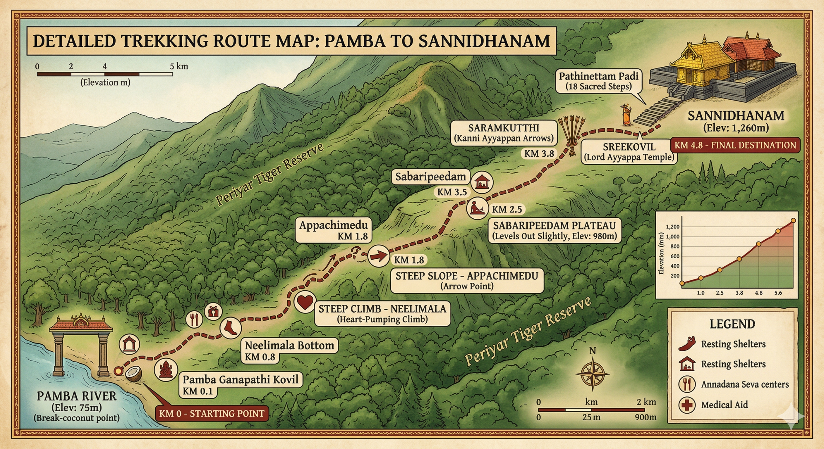
Average gradient: roughly 18%, with some Appachimedu sections touching about 35%.

Terrain type: semi-evergreen and moist deciduous forest inside a Tiger Reserve.

Rare feature: Urakuzhi Teertham near the Sannidhanam, where the water is remembered as disappearing into a rock cleft.

Center point and route layer

Map center: Sannidhanam at 9.4375, 77.0805.

Base layer: OpenTopoMap to show the mountainous terrain clearly.

Route line: Blue polyline representing the Swamy Ayyappan Road between the marked points.

Medical points: Red Cross markers now indicate the main medical and oxygen-support chain from Pamba to Sannidhanam.

Mobile use: Tap a milestone card first, then zoom the map only if you need a closer look.

MilestoneDistance From PambaKey Feature
Pamba River0.0 KMStart point and Pamba Ganapathi temple.
Neelimala0.8 KMThe steepest ascent; requires steady breathing.
Appachimedu1.8 KMFamous for its steep U-curves and forest deities.
Sabaripeedam3.5 KMThe plateau where the path levels out.
Saramkutthi3.8 KMWhere Kanni Ayyappans leave their wooden arrows.
Sannidhanam4.8 KMFinal destination and home of Lord Ayyappa.