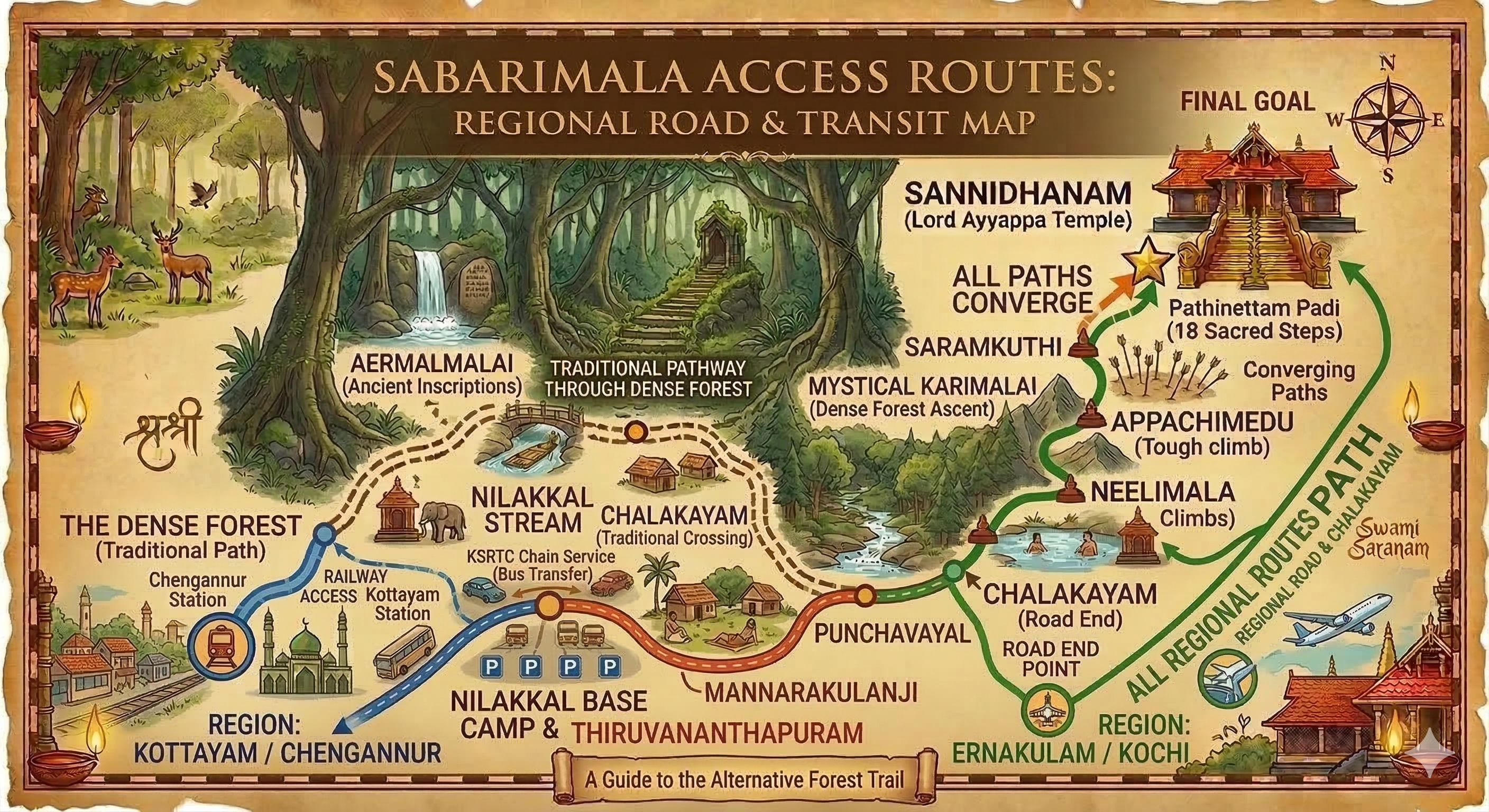
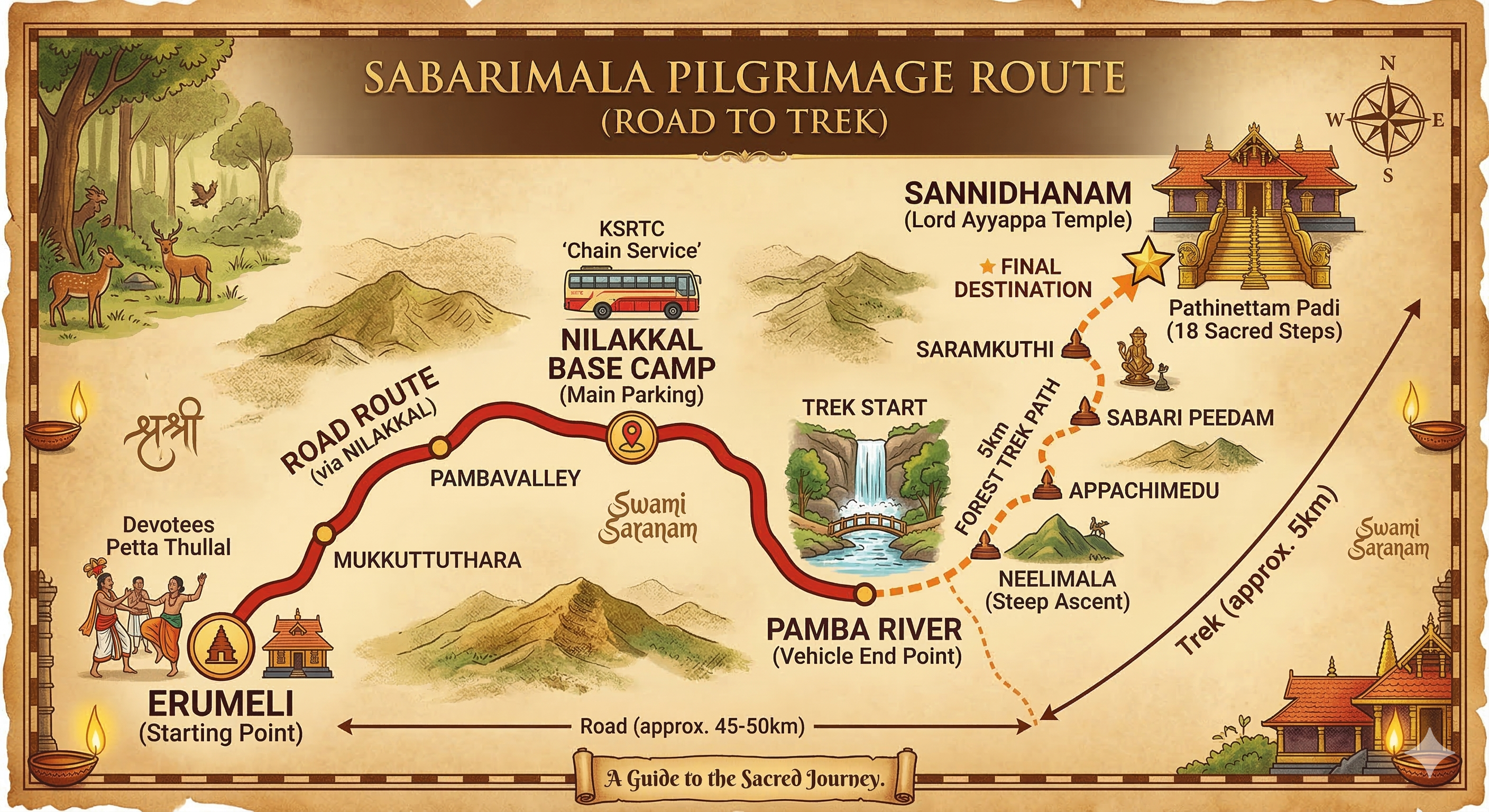
Erumeli - Chalakkayam - Sannidhanam
A visual memory of the classic long-path experience associated with the older forest-side tradition.
This page gathers the important visual references in one place: traditional pathways, district route planning, road movement, railhead support, air connection flow, sea arrival corridors, and sacred-point orientation. Use these as devotional planning aids and still confirm final travel through official channels before departure.
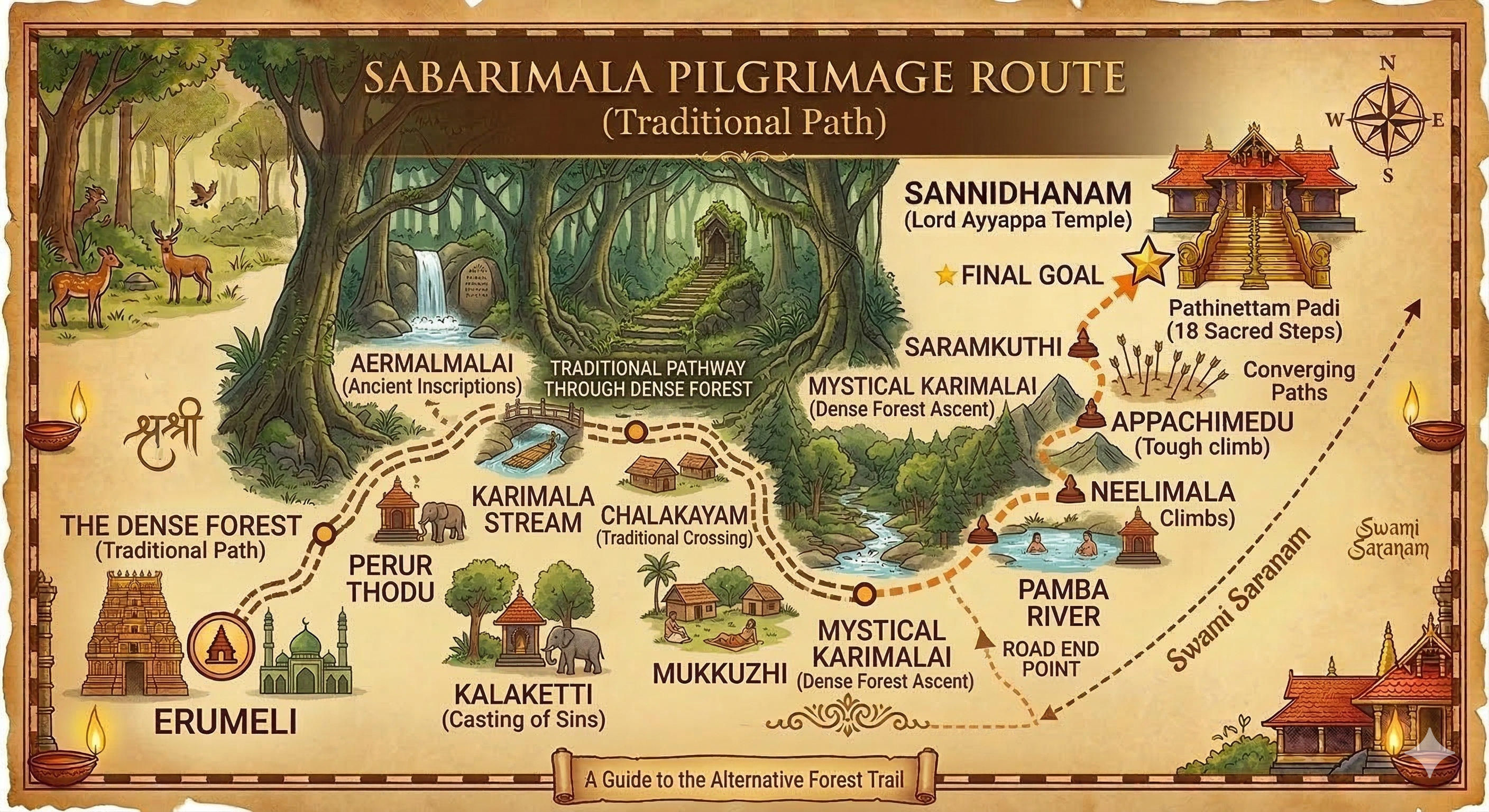
A visual memory of the classic long-path experience associated with the older forest-side tradition.
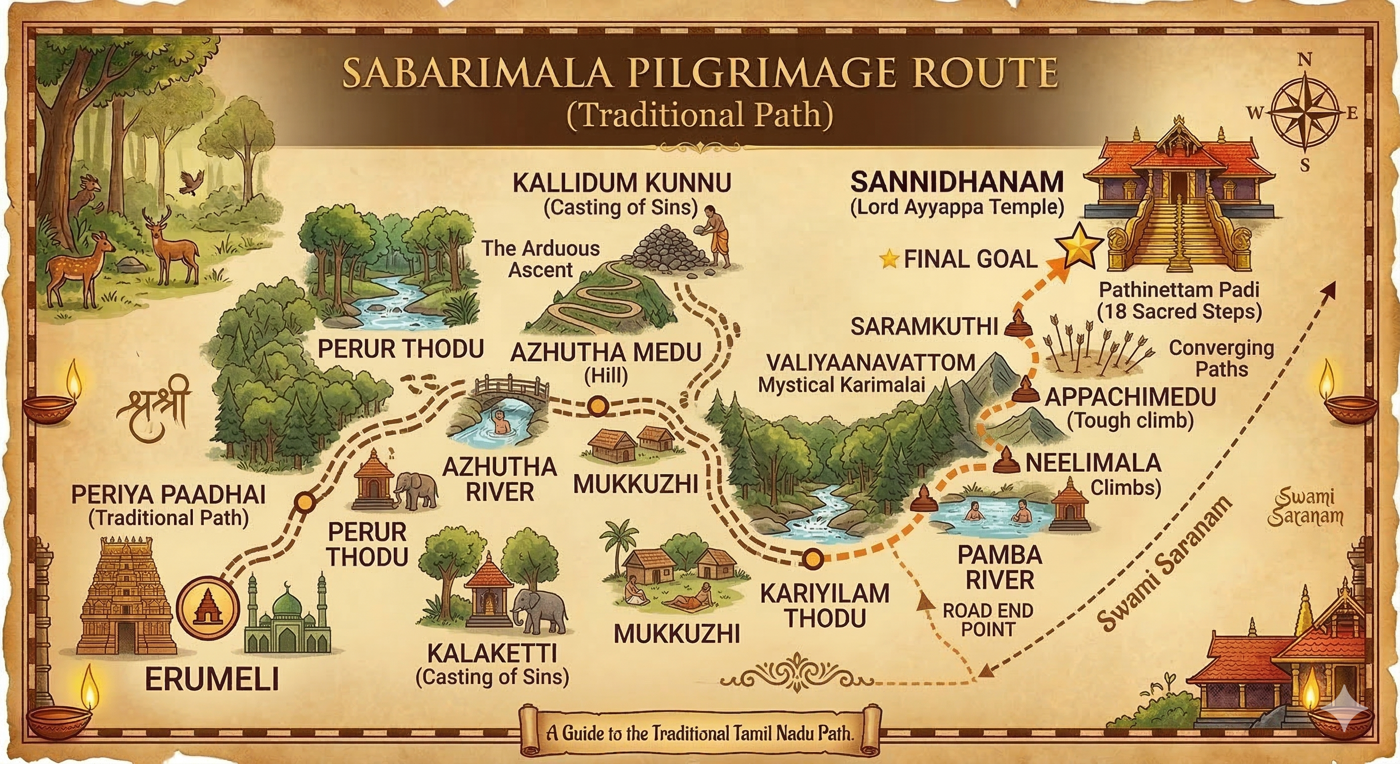
This version helps pilgrims understand the broader devotional flow of the Erumeli side before moving into more detailed route references.
Useful for understanding the eastern-side traditional movement remembered by many devotees.
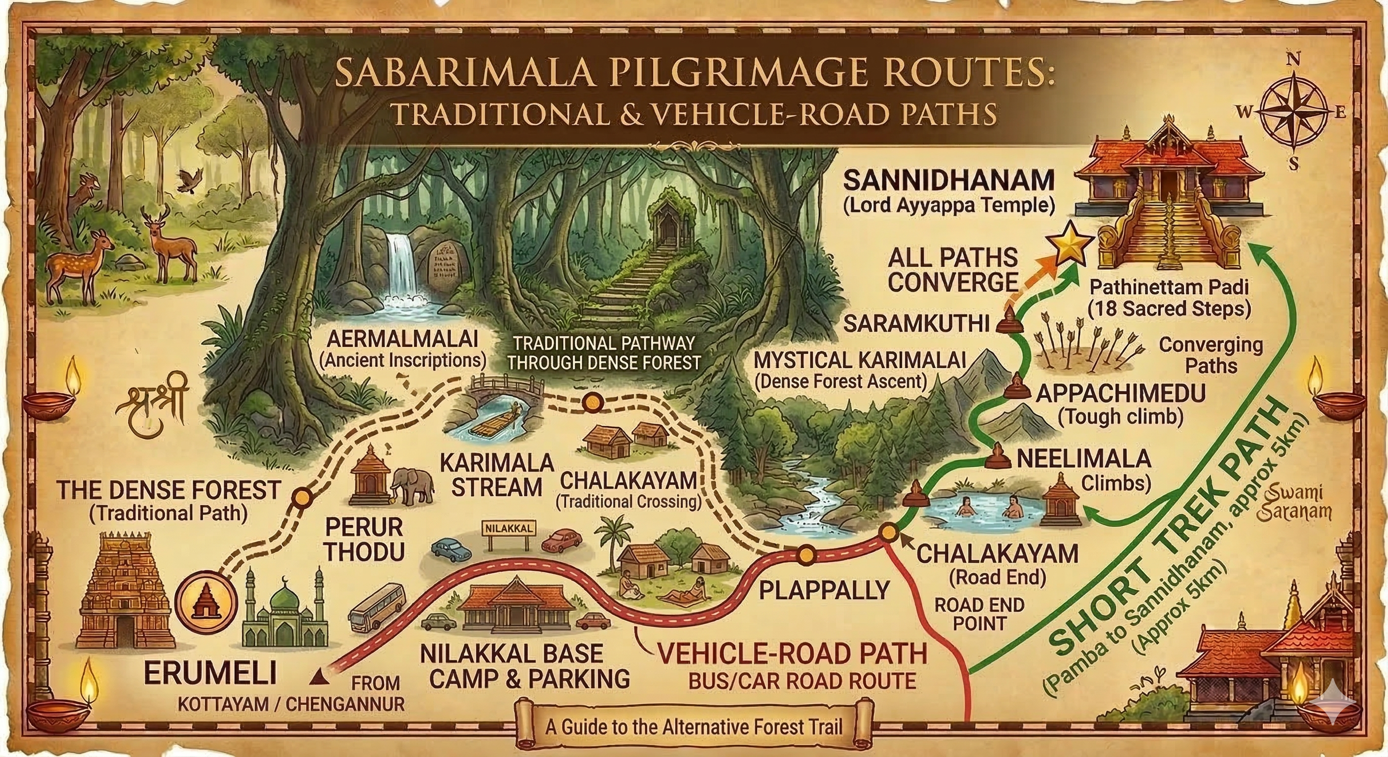
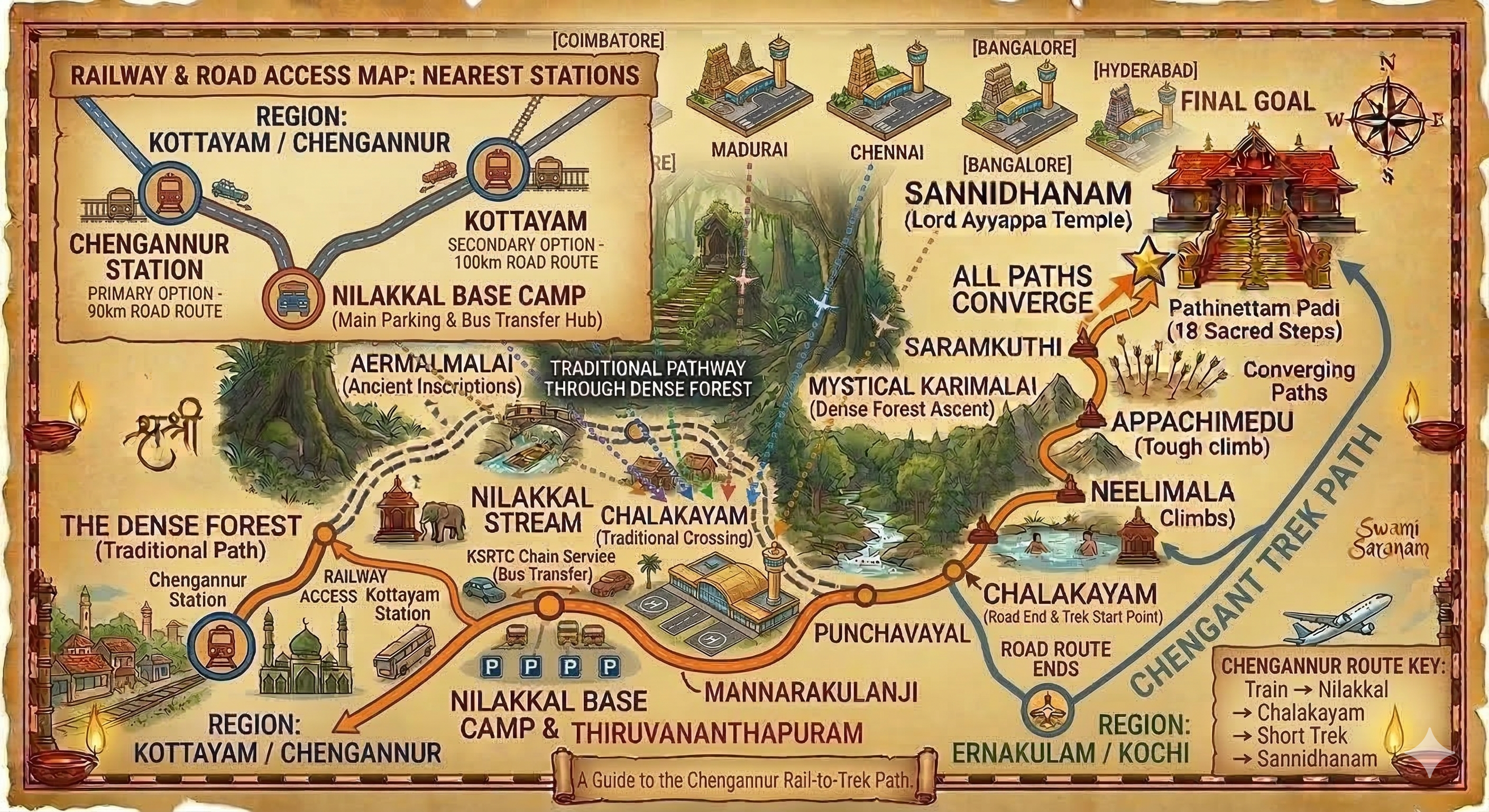
This reference helps groups understand where the devotional walking route and practical vehicle movement begin to separate.
These visuals are best for understanding devotional geography and route memory. They should not replace live control-room guidance, forest access instructions, or current seasonal safety restrictions.

Shows the broad movement from Thiruvananthapuram, Kollam, Pathanamthitta, Alappuzha, Kottayam, Idukki, Ernakulam, Thrissur, Palakkad, Malappuram, Kozhikode, Wayanad, Kannur, and Kasaragod toward Sannidhanam.
A simple road-planning visual for devotees trying to connect long-distance travel with the final hill-sector movement.
Helpful for southern Kerala devotees or interstate travellers coming through the capital side.
Useful for devotees linking rail or road movement from Kollam into the pilgrimage corridor.
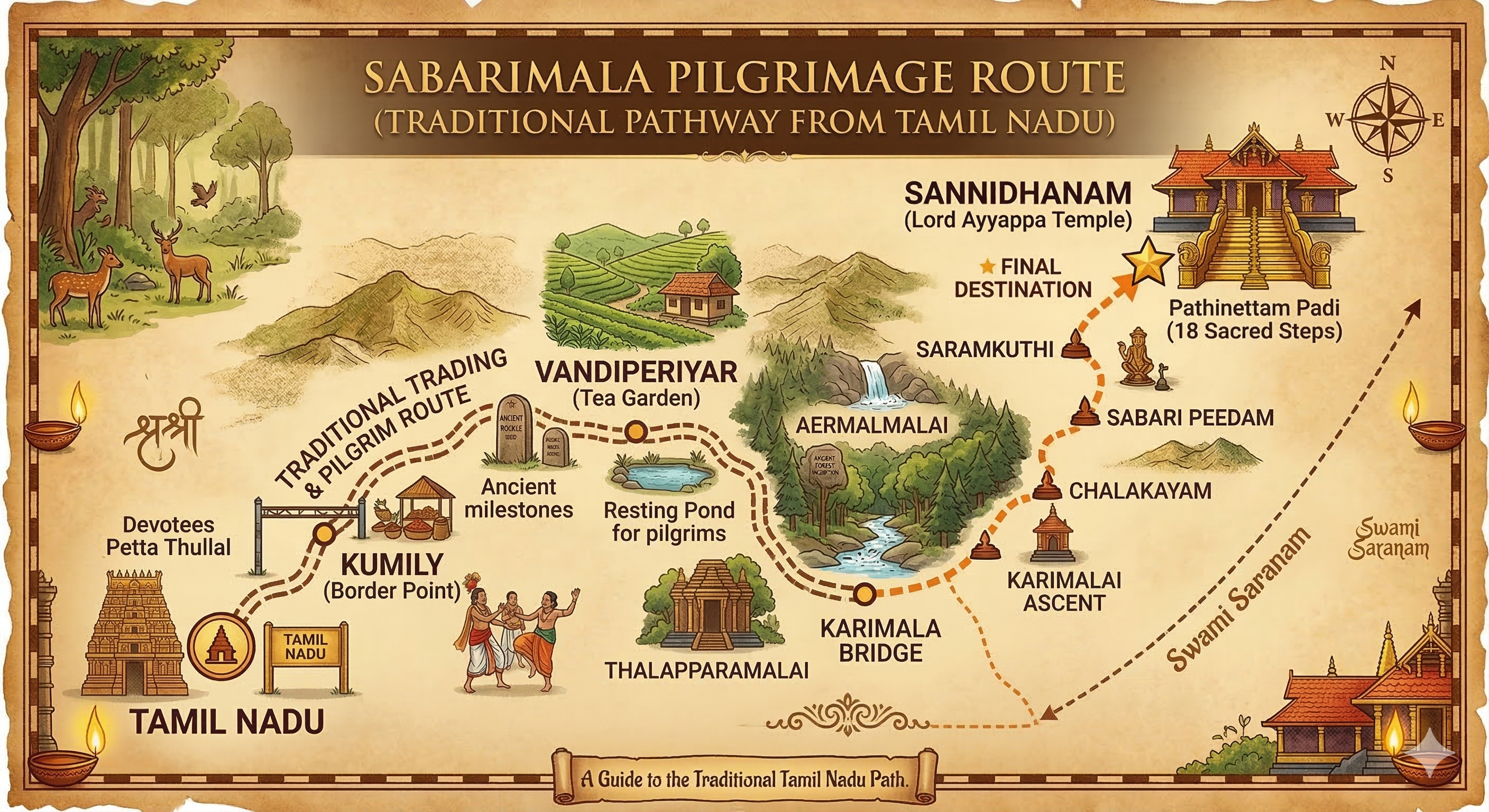
Useful when aligning the sacred memory of Erumeli with the practical approach toward the later control points.
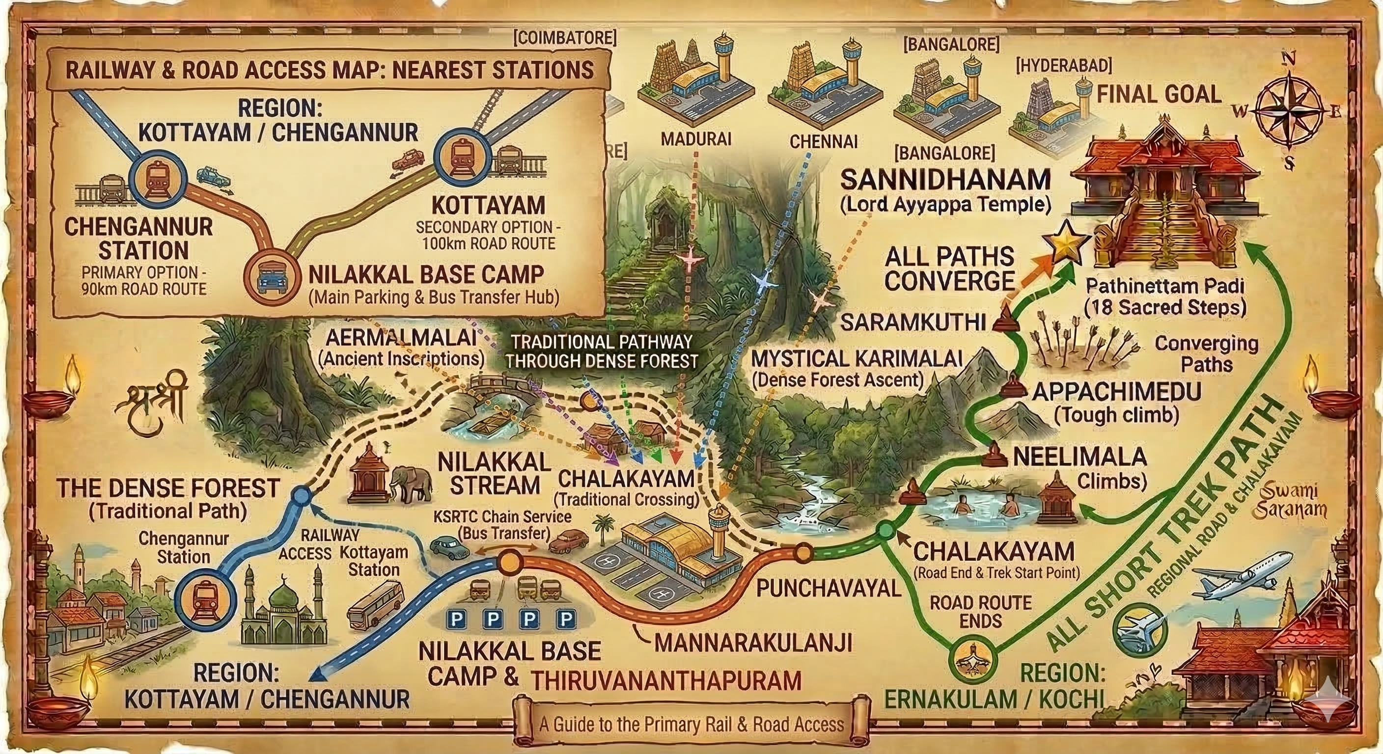
Helpful for choosing between Chengannur, Kottayam, Ernakulam, and Thiruvananthapuram depending on your train and onward bus plan.
Illustrates why Chengannur remains the most practical rail gateway for many devotees.

Connect origin cities such as Kannur, Kozhikode, Coimbatore, Madurai, Chennai, Bengaluru, and Hyderabad through Kochi or Thiruvananthapuram before continuing by road.

Shows the practical continuation from Kochi Port, Alappuzha, and Vizhinjam or Thiruvananthapuram sea sectors into the central pilgrimage roads.
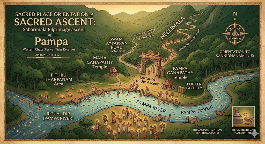
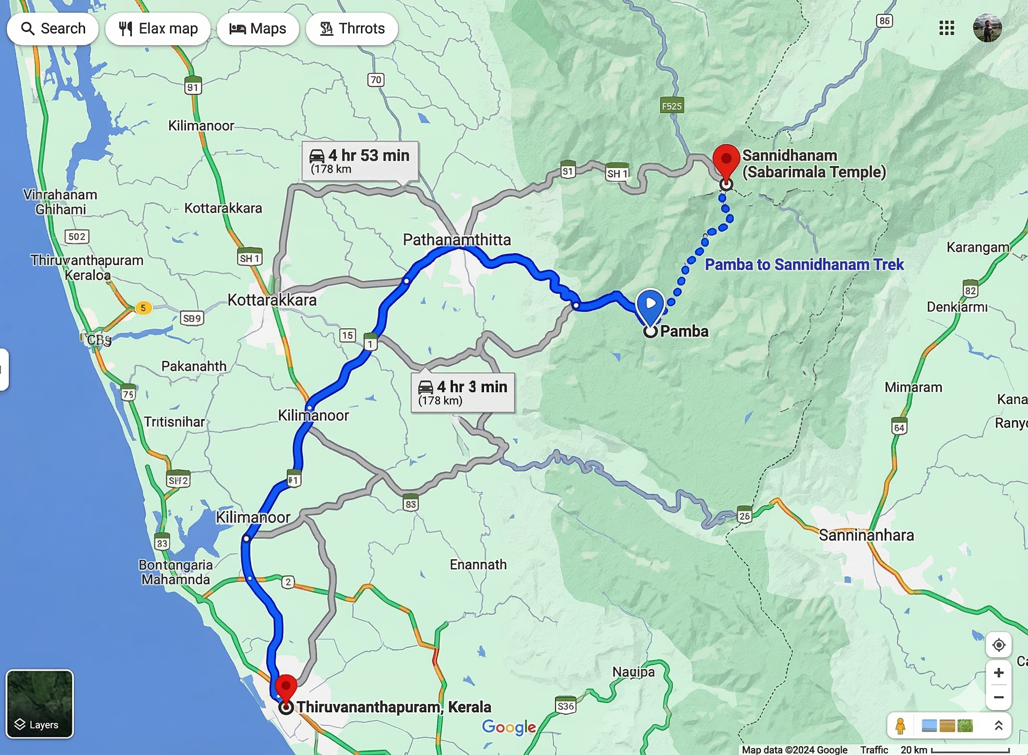
Helps devotees understand Pampa as the sacred threshold of purification, regrouping, and preparation before the climb toward Sannidhanam.
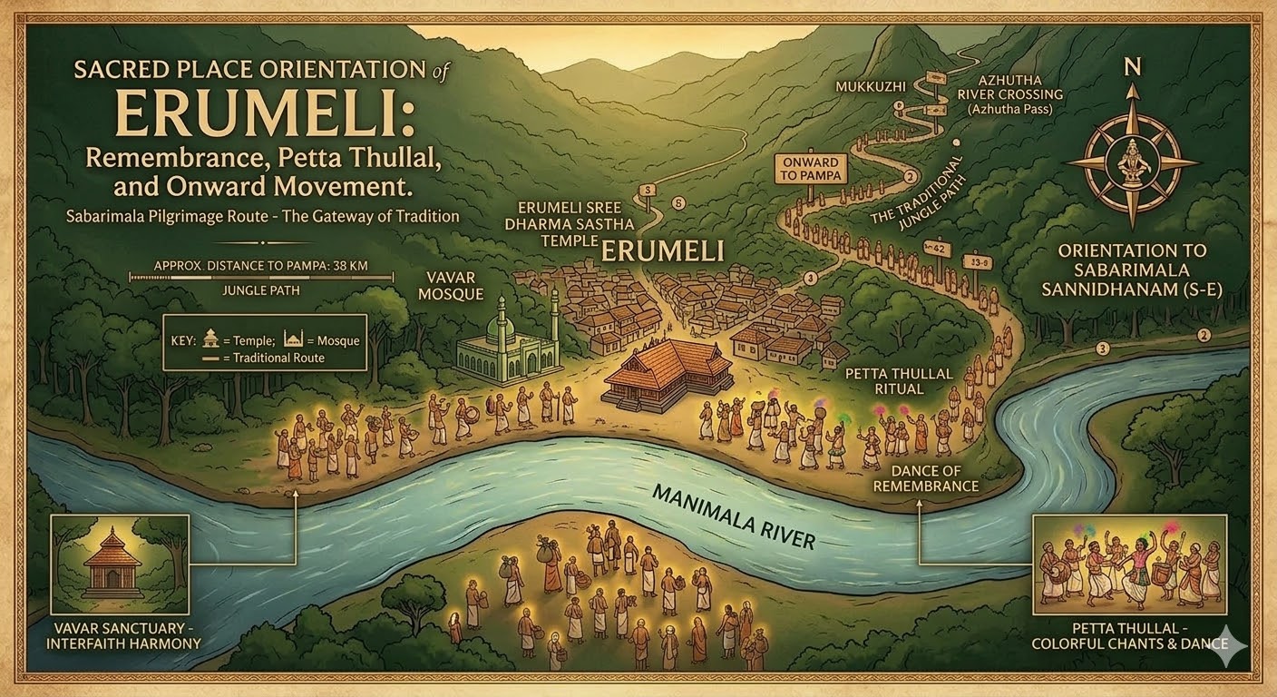
Shows Erumeli in its proper devotional context as a remembered gateway of Petta Thullal, Vavar reverence, and onward yatra movement.
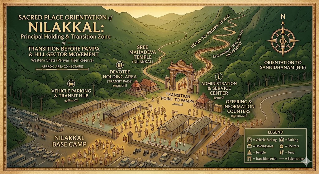
Useful for seeing Nilakkal as the principal transport, holding, and transition zone before the final Pampa sector opens before the pilgrim.
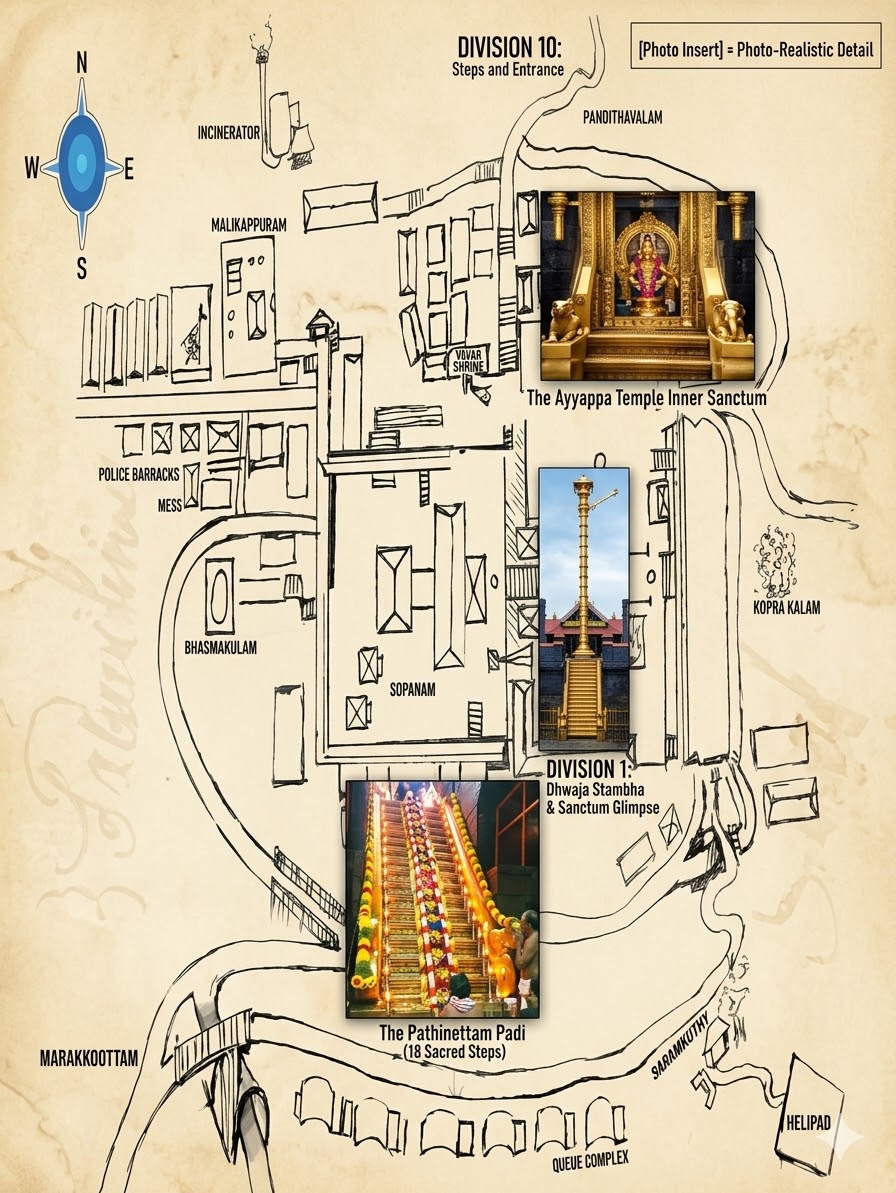
Places the final temple precinct in clearer context for devotees who want to visualize the sacred destination before darshan-focused reading.

A cleaner overall route visual for devotees who want a broad understanding before moving into rail, road, or forest-specific maps.
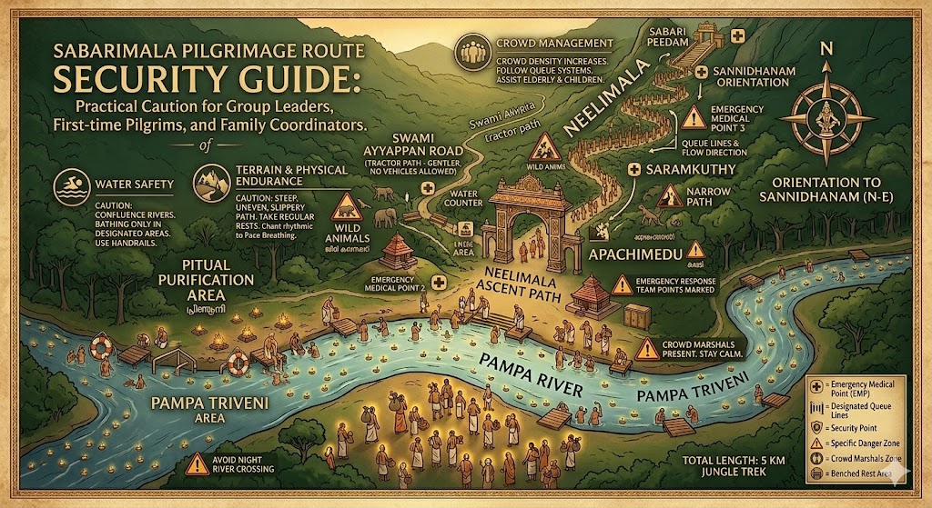
Useful as a practical pre-travel reference for group leaders, first-time pilgrims, and family coordinators who want safer movement through changing route conditions.
Use this page together with Pilgrimage Guide, Travel and Stay Support, and First-Time Pilgrim so the maps are matched with live travel guidance, safety advice, and darshan preparation.